|
search place name
|
||
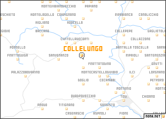
Collelungo (Italy)Collelungo is a town in Italy. An overview map of the region around Collelungo is displayed below.
regional and 3d topo map of Collelungo, Italy ::
Collelungo airports ::
The nearest airport is PEG - Perugia, located 30.1 km north east of Collelungo.
Other airports nearby include SAY - Siena Ampugnano (96.7 km north west), GRS - Grosseto (102.5 km west), FCO - Rome Fiumicino (118.1 km south), CIA - Rome Ciampino (120.8 km south), Nearby towns ::
Ripalvella (1.9km south) //
Marsciano (3.9km north) //
Civitella deʼ Conti (3.9km north) //
Fratta Todina (3.3km south east) //
Poggio Aquilone (4.6km north west) //
Monte Castello di Vibio (4.6km south east) //
San Venanzo (4.1km west) //
Doglio (5.6km south) //
Monte Molino (5.5km south east) //
Morcella (7.5km north) //
Cecanibbi (6.9km south east) //
Piano di San Martino (9.2km south east) //
[all distances 'as the bird flies' and approximate] 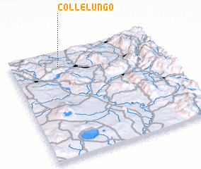 Places with similar names to Collelungo, Italy ::
// Caliling (PH)
// Coliling (PH)
// Coliling (PH)
// Culilang (PH)
// Galalang (PH)
// Collelungo (IT)
// Collelungo (IT)
// Collelungo (IT)
// Goliullinka (RU)
// Kiala-Longo (CD)
Disclaimer :: Information on this page comes without warranty of any kind |
||
|
Where is Collelungo? Elevation and coordinates ::
Latitude (lat): 42°52'0"N Longitude (lon): 12°19'0"E
Elevation (approx.): 457m (map arrows pan, magnifying glasses zoom) |
||
|
Visiting Collelungo? Hotel/Accommodation ::
Book a hotel in Collelungo Travel Guide ::
Buy a travel guide for Italy rental cars ::
car rental offers GPS waypoint ::
download a GPX waypoint (PoI) of Collelungo for your GPS receiver
|
||