|
search place name
|
||
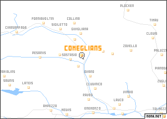
Comeglians (Friuli-Venezia Giulia, Italy)Comeglians is a town in the Friuli-Venezia Giulia region of Italy. An overview map of the region around Comeglians is displayed below.
regional and 3d topo map of Comeglians, Italy ::
Comeglians airports ::
The nearest airport is AVB - Aviano Ab (Pagliano E Gori), located 57.6 km south of Comeglians.
Other airports nearby include TRS - Ronchi De Legionari Ronchi Dei Legionari (90.0 km south east), TSF - Treviso (109.4 km south west), KLU - Klagenfurt (Worthersee Intl) (114.1 km east), BZO - Bolzano (117.9 km west), Nearby towns ::
Ovasta (1.7km south west) //
Sostasio (2.0km west) //
Valpicetto (3.0km north) //
Ovaro (3.9km south) //
Salars (3.6km north east) //
Rigolato (4.7km north) //
Prato Carnico (3.8km west) //
Givigliana (5.9km north) //
Ravascletto (4.7km east) //
Cludinico (6.8km south) //
Collina (8.3km north) //
Sigiletto (7.7km north west) //
[all distances 'as the bird flies' and approximate] 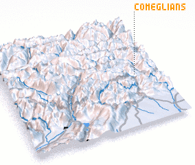 Places with similar names to Comeglians, Italy :: Disclaimer :: Information on this page comes without warranty of any kind |
||
|
Where is Comeglians? Elevation and coordinates ::
Latitude (lat): 46°31'0"N Longitude (lon): 12°51'36"E
Elevation (approx.): 630m (map arrows pan, magnifying glasses zoom) |
||
|
Visiting Comeglians? Hotel/Accommodation ::
Book a hotel in Comeglians Travel Guide ::
Buy a travel guide for Italy rental cars ::
car rental offers GPS waypoint ::
download a GPX waypoint (PoI) of Comeglians for your GPS receiver
|
||