|
search place name
|
||
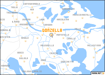
Donzella (Veneto, Italy)Donzella is a town in the Veneto region of Italy. An overview map of the region around Donzella is displayed below.
regional and 3d topo map of Donzella, Italy ::
Donzella airports ::
The nearest airport is VCE - Venice Venezia Tessera, located 63.4 km north of Donzella.
Other airports nearby include QPA - Padova (63.8 km north west), TSF - Treviso (80.0 km north), FRL - Forli (84.9 km south), BLQ - Bologna (93.8 km south west), Nearby towns ::
Ca Tiepolo (1.6km north) //
Ca Venier (2.6km north) //
Caʼ Pisani (3.5km north) //
Ca Vendramin (2.7km west) //
Porto Tolle (2.7km east) //
Polesinello (4.1km south) //
Alberazzo (3.8km west) //
Cascine Ca Pasta (5.9km north west) //
Lago (5.9km north west) //
Manzoleria (6.0km north east) //
Ca Latis (6.8km south) //
Ca Mello (5.0km east) //
Vallona (8.2km north west) //
Maestrazza (8.4km north east) //
[all distances 'as the bird flies' and approximate]  Places with similar names to Donzella, Italy ::
Disclaimer :: Information on this page comes without warranty of any kind |
||
|
Where is Donzella? Elevation and coordinates ::
Latitude (lat): 44°56'7"N Longitude (lon): 12°19'55"E
Elevation (approx.): -4m (map arrows pan, magnifying glasses zoom) |
||
|
Visiting Donzella? Hotel/Accommodation ::
Book a hotel in Donzella Travel Guide ::
Buy a travel guide for Italy rental cars ::
car rental offers GPS waypoint ::
download a GPX waypoint (PoI) of Donzella for your GPS receiver
|
||