|
search place name
|
||
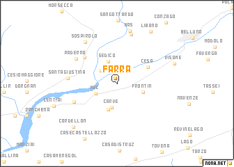
Farra (Veneto, Italy)Farra is a town in the Veneto region of Italy. An overview map of the region around Farra is displayed below.
regional and 3d topo map of Farra, Italy ::
Farra airports ::
The nearest airport is AVB - Aviano Ab (Pagliano E Gori), located 37.8 km east of Farra.
Other airports nearby include TSF - Treviso (48.3 km south), VCE - Venice Venezia Tessera (66.4 km south), VIC - Vicenza (72.2 km south west), BZO - Bolzano (74.0 km north west), Nearby towns ::
Bribano (2.9km north west) //
Mel (2.9km south west) //
Sedico (3.7km north) //
Carve (3.9km south) //
Frontin (3.2km south east) //
SantʼAntonio Tortal (4.2km south) //
Cesa (4.3km north east) //
Oregne (5.5km north west) //
Campo San Pietro (5.6km south west) //
Paderno (6.1km north west) //
Santa Giustina (5.5km west) //
Vignole (8.0km north) //
Sospirolo (7.6km north west) //
Mas (8.6km north) //
Libano (9.1km north east) //
Cordellon (8.5km south west) //
Case Castellazzo (9.5km south) //
[all distances 'as the bird flies' and approximate] 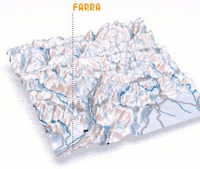 Places with similar names to Farra, Italy ::
Disclaimer :: Information on this page comes without warranty of any kind |
||
|
Where is Farra? Elevation and coordinates ::
Latitude (lat): 46°4'45"N Longitude (lon): 12°6'48"E
Elevation (approx.): 329m (map arrows pan, magnifying glasses zoom) |
||
|
Visiting Farra? Hotel/Accommodation ::
Book a hotel in Farra Travel Guide ::
Buy a travel guide for Italy rental cars ::
car rental offers GPS waypoint ::
download a GPX waypoint (PoI) of Farra for your GPS receiver
|
||