|
search place name
|
||
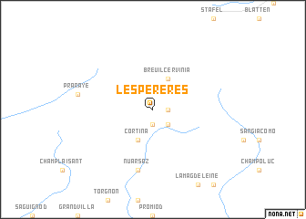
Les Perères (Italy)Les Perères is a town in Italy. An overview map of the region around Les Perères is displayed below.
regional and 3d topo map of Les Perères, Italy ::
Les Perères airports ::
The nearest airport is SIR - Sion, located 42.0 km north west of Les Perères.
Other airports nearby include TRN - Torino (77.8 km south), MXP - Milano Malpensa (91.5 km east), LUG - Lugano (101.0 km east), QNJ - Annemasse (109.3 km west), Nearby towns ::
Singlin (1.3km east) //
Valtournanche (1.9km south) //
Crépin (2.3km south east) //
Breuil-Cervinia (3.9km north) //
Breuil (3.9km north) //
Cortina (3.9km south) //
Nuarsaz (7.5km south) //
[all distances 'as the bird flies' and approximate] 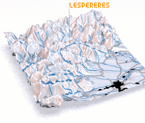 Places with similar names to Les Perères, Italy ::
Disclaimer :: Information on this page comes without warranty of any kind |
||
|
Where is Les Perères? Elevation and coordinates ::
Latitude (lat): 45°54'0"N Longitude (lon): 7°37'0"E
Elevation (approx.): 1779m (map arrows pan, magnifying glasses zoom) |
||
|
Visiting Les Perères? Hotel/Accommodation ::
Book a hotel in Les Perères Travel Guide ::
Buy a travel guide for Italy rental cars ::
car rental offers GPS waypoint ::
download a GPX waypoint (PoI) of Les Perères for your GPS receiver
|
||