|
search place name
|
||
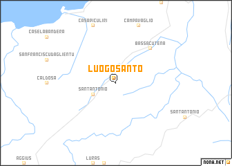
Luogo Santo (Italy)Luogo Santo is a town in Italy. An overview map of the region around Luogo Santo is displayed below.
regional and 3d topo map of Luogo Santo, Italy ::
Luogo Santo airports ::
The nearest airport is OLB - Olbia Costa Smeralda, located 31.6 km south east of Luogo Santo.
Other airports nearby include FSC - Figari Sud Corse (50.8 km north), AHO - Alghero (89.6 km south west), SOZ - Solenzara (98.6 km north), AJA - Ajaccio Campo Dell Oro (102.5 km north), Nearby towns ::
SantʼAntonio (3.4km south west) //
Bassacutena (7.0km north east) //
[all distances 'as the bird flies' and approximate]  Places with similar names to Luogo Santo, Italy ::
// La Quisanda (VE)
// Lagosanto (IT)
// Liuxiandao (CN)
// Lagoa Santa (BR)
// Lakasund (SE)
// Leksand (SE)
// Lekosandi (GE)
// Le Quesnot (FR)
Disclaimer :: Information on this page comes without warranty of any kind |
||
|
Where is Luogo Santo? Elevation and coordinates ::
Latitude (lat): 41°3'0"N Longitude (lon): 9°12'0"E
Elevation (approx.): 377m (map arrows pan, magnifying glasses zoom) |
||
|
Visiting Luogo Santo? Hotel/Accommodation ::
Book a hotel in Luogo Santo Travel Guide ::
Buy a travel guide for Italy rental cars ::
car rental offers GPS waypoint ::
download a GPX waypoint (PoI) of Luogo Santo for your GPS receiver
|
||