|
search place name
|
||
Negi (Italy)Negi is a town in Italy. An overview map of the region around Negi is displayed below.
regional and 3d topo map of Negi, Italy ::

Negi airports ::
The nearest airport is ALL - Albenga, located 40.9 km north east of Negi.
Other airports nearby include NCE - Nice Cote D Azur (44.4 km south west), CEQ - Cannes Mandelieu (69.2 km south west), CUF - Levaldigi (77.7 km north), GOA - Genoa Genova Sestri (110.5 km north east), Nearby towns ::
Merli (2.7km east) //
San Romolo (2.7km east) //
Frantoio Massabo (2.7km west) //
Perinaldo (3.3km north west) //
Seborga (3.9km south) //
Coldirodi (4.6km south east) //
Vallebona (4.6km south west) //
Baiardo (5.7km north) //
Berzi (5.7km north) //
Soldano (4.4km south west) //
San Giovanni Battista (4.4km south east) //
San Bartolomeo (4.4km south east) //
Ospedaletti (5.7km south) //
Apricale (5.5km north west) //
Case Toca (6.2km north west) //
Case Romagnoni (6.2km north west) //
San Biagio della Cima (5.5km south west) //
San Lorenzo (5.5km south east) //
Borghetto San Nicolò (6.2km south west) //
Sasso di Bordighera (6.2km south west) //
San Sebastiano (7.5km north) //
San Gregorio (7.5km north) //
Vallecrosia (6.9km south west) //
Isolabona (6.5km north west) //
Ceriana (6.5km north east) //
San Remo (6.5km south east) //
Piani di Vallecrosia (8.4km south west) //
Casa Veragne (8.4km north west) //
Vignai (9.1km north east) //
[all distances 'as the bird flies' and approximate] 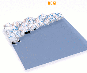 Places with similar names to Negi, Italy ::
Disclaimer :: Information on this page comes without warranty of any kind |
||
|
Where is Negi? Elevation and coordinates ::
Latitude (lat): 43°51'0"N Longitude (lon): 7°42'0"E
Elevation (approx.): 797m (map arrows pan, magnifying glasses zoom) |
||
|
Visiting Negi? Hotel/Accommodation ::
Book a hotel in Negi Travel Guide ::
Buy a travel guide for Italy rental cars ::
car rental offers GPS waypoint ::
download a GPX waypoint (PoI) of Negi for your GPS receiver
|
||