|
search place name
|
||
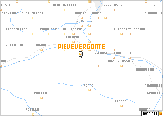
Pieve Vergonte (Italy)Pieve Vergonte is a town in Italy. An overview map of the region around Pieve Vergonte is displayed below.
regional and 3d topo map of Pieve Vergonte, Italy ::
Pieve Vergonte airports ::
The nearest airport is LUG - Lugano, located 49.9 km east of Pieve Vergonte.
Other airports nearby include MXP - Milano Malpensa (54.5 km south east), SIR - Sion (76.7 km west), LIN - Milan Linate (99.9 km south east), TRN - Torino (101.0 km south west), Nearby towns ::
Piedimulera (1.9km north) //
Vogogna (2.3km north east) //
Campo Albino (3.9km north) //
Megolo di Mezzo (3.2km south east) //
Coloria (3.9km north) //
Gozzi (3.2km north west) //
Cuzzego (5.7km north) //
Pallanzeno (5.7km north) //
Alpe Basciumo (6.1km north west) //
Premosello Chiovenda (5.1km east) //
Villadossola (7.4km north) //
Alpe Lagarasc (5.5km east) //
Forno (7.5km south) //
Chiesa (7.5km north) //
Camblione (7.6km north west) //
[all distances 'as the bird flies' and approximate]  Places with similar names to Pieve Vergonte, Italy :: Disclaimer :: Information on this page comes without warranty of any kind |
||
|
Where is Pieve Vergonte? Elevation and coordinates ::
Latitude (lat): 46°0'0"N Longitude (lon): 8°16'0"E
Elevation (approx.): 425m (map arrows pan, magnifying glasses zoom) |
||
|
Visiting Pieve Vergonte? Hotel/Accommodation ::
Book a hotel in Pieve Vergonte Travel Guide ::
Buy a travel guide for Italy rental cars ::
car rental offers GPS waypoint ::
download a GPX waypoint (PoI) of Pieve Vergonte for your GPS receiver
|
||