|
search place name
|
||
Ponte di Via Levata (Italy)Ponte di Via Levata is a town in Italy. An overview map of the region around Ponte di Via Levata is displayed below.
regional and 3d topo map of Ponte di Via Levata, Italy ::

Ponte di Via Levata airports ::
The nearest airport is PMF - Parma, located 30.6 km west of Ponte di Via Levata.
Other airports nearby include BLQ - Bologna (58.3 km south east), VRN - Villafranca (64.6 km north), VBS - Montichiari (71.8 km north west), QPZ - Piacenza (76.4 km west), Nearby towns ::
Ponte della Forca (2.3km south west) //
San Bernardino (3.7km north) //
Vezzola (4.5km south east) //
Ost (5.7km south) //
Santa Vittoria (4.4km north west) //
Novellara (4.4km north east) //
Catellani (5.4km south west) //
Ponte Mantovano (5.3km west) //
Bagnolo in Piano (7.5km south) //
Case del Cantone (6.8km south west) //
Castello della Madonnina (7.9km south) //
Cadelbosco di Sotto (6.4km south west) //
Casa Pedrelli (7.7km south west) //
Gualtieri (8.4km north west) //
Pieve Saliceto (9.1km north west) //
Fosdondo (9.1km south east) //
[all distances 'as the bird flies' and approximate] 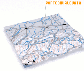 Places with similar names to Ponte di Via Levata, Italy :: Disclaimer :: Information on this page comes without warranty of any kind |
||
|
Where is Ponte di Via Levata? Elevation and coordinates ::
Latitude (lat): 44°50'0"N Longitude (lon): 10°41'0"E
Elevation (approx.): 21m (map arrows pan, magnifying glasses zoom) |
||
|
Visiting Ponte di Via Levata? Hotel/Accommodation ::
Book a hotel in Ponte di Via Levata Travel Guide ::
Buy a travel guide for Italy rental cars ::
car rental offers GPS waypoint ::
download a GPX waypoint (PoI) of Ponte di Via Levata for your GPS receiver
|
||