|
search place name
|
||
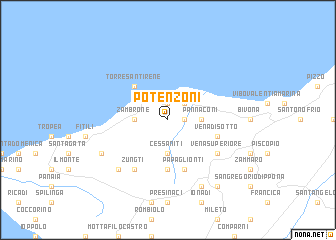
Potenzoni (Italy)Potenzoni is a town in Italy. An overview map of the region around Potenzoni is displayed below.
regional and 3d topo map of Potenzoni, Italy ::
Potenzoni airports ::
The nearest airport is SUF - Lamezia Terme, located 30.1 km north east of Potenzoni.
Other airports nearby include REG - Reggio Calabria (76.7 km south west), CRV - Crotone (98.0 km east), CTA - Catania Fontanarossa (160.3 km south west), NSY - Sigonella (173.2 km south west), Nearby towns ::
Sciconi (1.4km east) //
San Costantino (1.9km north) //
San Leo (1.9km north) //
Conidoni (2.4km north east) //
Briatico (2.4km north east) //
Cessaniti (3.7km south) //
San Marco (3.7km south) //
Pannaconi (2.9km east) //
Zambrone (2.9km west) //
Mandaradoni (2.9km west) //
Torre SantʼIrene (4.7km north west) //
Case Pagliarone (5.6km south) //
Papaglionti (5.7km south) //
Vena di Sotto (4.7km south east) //
Tripatni (4.7km south east) //
Vena Superiore (5.7km south east) //
Zungti (6.3km south west) //
Casa Nucara (6.3km south west) //
Casa dʼAcquino (7.1km south west) //
Zaccanopoli (6.9km south west) //
Arzona (8.0km south) //
San Costantino Calabro (8.6km south east) //
[all distances 'as the bird flies' and approximate] 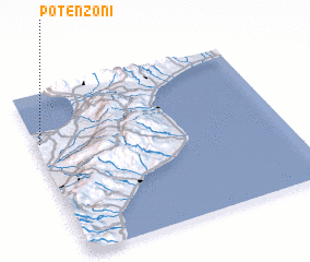 Places with similar names to Potenzoni, Italy ::
// Pattensen (DE)
// Pattensen (DE)
// Peddinghausen (DE)
// Pedinghausen (DE)
// Pödinghausen (DE)
// Putensen (DE)
// Podnieśno (PL)
// Patansīn (PK)
// Podenzana (IT)
// Podenzano (IT)
Disclaimer :: Information on this page comes without warranty of any kind |
||
|
Where is Potenzoni? Elevation and coordinates ::
Latitude (lat): 38°42'0"N Longitude (lon): 16°1'0"E
Elevation (approx.): 165m (map arrows pan, magnifying glasses zoom) |
||
|
Visiting Potenzoni? Hotel/Accommodation ::
Book a hotel in Potenzoni Travel Guide ::
Buy a travel guide for Italy rental cars ::
car rental offers GPS waypoint ::
download a GPX waypoint (PoI) of Potenzoni for your GPS receiver
|
||