|
search place name
|
||
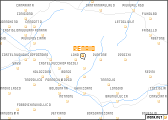
Renaio (Italy)Renaio is a town in Italy. An overview map of the region around Renaio is displayed below.
regional and 3d topo map of Renaio, Italy ::
Renaio airports ::
The nearest airport is PSA - Pisa, located 47.3 km south of Renaio.
Other airports nearby include FLR - Firenze (64.0 km south east), BLQ - Bologna (78.3 km north east), PMF - Parma (82.4 km north), QPZ - Piacenza (110.2 km north west), Nearby towns ::
Lama (1.3km west) //
Montebono (1.3km west) //
Sommocolonia (1.9km south) //
Puntone (2.7km east) //
Coreglia Antelminelli (3.7km south) //
Barga (4.6km south west) //
Castelvecchio Pascoli (4.4km south west) //
Ghivizzano (7.4km south) //
Il Ciocco (5.3km west) //
Tereglio (6.8km south east) //
Fornaci di Barga (6.8km south west) //
Bolognana (8.4km south west) //
Longoio (9.1km south east) //
[all distances 'as the bird flies' and approximate] 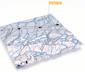 Places with similar names to Renaio, Italy ::
Disclaimer :: Information on this page comes without warranty of any kind |
||
|
Where is Renaio? Elevation and coordinates ::
Latitude (lat): 44°6'0"N Longitude (lon): 10°31'0"E
Elevation (approx.): 773m (map arrows pan, magnifying glasses zoom) |
||
|
Visiting Renaio? Hotel/Accommodation ::
Book a hotel in Renaio Travel Guide ::
Buy a travel guide for Italy rental cars ::
car rental offers GPS waypoint ::
download a GPX waypoint (PoI) of Renaio for your GPS receiver
|
||