|
search place name
|
||
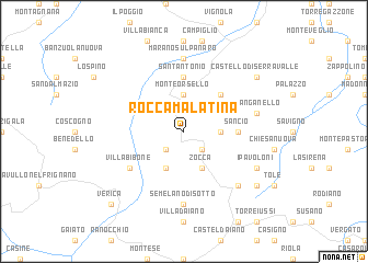
Rocca Malatina (Italy)Rocca Malatina is a town in Italy. An overview map of the region around Rocca Malatina is displayed below.
regional and 3d topo map of Rocca Malatina, Italy ::
Rocca Malatina airports ::
The nearest airport is BLQ - Bologna, located 30.7 km north east of Rocca Malatina.
Other airports nearby include FLR - Firenze (66.5 km south), PMF - Parma (72.4 km north west), PSA - Pisa (90.3 km south west), FRL - Forli (90.5 km east), Nearby towns ::
Zocchetta (2.3km south east) //
Samone (2.3km south west) //
Monte Ombraro (2.6km east) //
Monteorsello (3.7km north) //
Zocca (3.9km south) //
Missano (3.9km south) //
I Boschi (4.6km north east) //
Sancio (4.0km east) //
SantʼAntonio (5.6km north) //
Guiglia (5.6km north) //
Villa Bibone (5.4km south west) //
Rosola (7.4km south) //
Semelano di Sotto (7.4km south) //
Marano sul Panaro (7.4km north) //
Stanganello (5.6km east) //
Casa San Giacomo (6.8km south east) //
I Pavoloni (6.5km south east) //
Dragodena (7.7km south east) //
Castello di Serravalle (7.7km north east) //
Verica (9.1km south west) //
[all distances 'as the bird flies' and approximate]  Places with similar names to Rocca Malatina, Italy :: Disclaimer :: Information on this page comes without warranty of any kind |
||
|
Where is Rocca Malatina? Elevation and coordinates ::
Latitude (lat): 44°23'0"N Longitude (lon): 10°58'0"E
Elevation (approx.): 517m (map arrows pan, magnifying glasses zoom) |
||
|
Visiting Rocca Malatina? Hotel/Accommodation ::
Book a hotel in Rocca Malatina Travel Guide ::
Buy a travel guide for Italy rental cars ::
car rental offers GPS waypoint ::
download a GPX waypoint (PoI) of Rocca Malatina for your GPS receiver
|
||