|
search place name
|
||
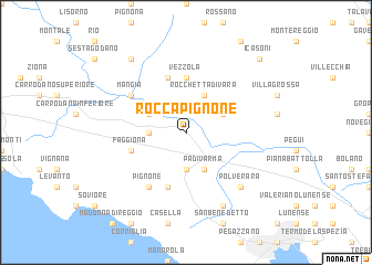
Roccapignone (Italy)Roccapignone is a town in Italy. An overview map of the region around Roccapignone is displayed below.
regional and 3d topo map of Roccapignone, Italy ::
Roccapignone airports ::
The nearest airport is GOA - Genoa Genova Sestri, located 76.0 km west of Roccapignone.
Other airports nearby include QPZ - Piacenza (77.4 km north), PSA - Pisa (78.5 km south east), PMF - Parma (80.3 km north east), FLR - Firenze (125.1 km east), Nearby towns ::
Borghetto di Vara (2.7km west) //
Bracelli (3.7km south) //
Beverone (3.2km north east) //
Brugnato (3.2km north west) //
Rocchetta di Vara (3.9km north) //
Padivarma (3.9km south) //
Vezzola (5.6km north) //
Madonna del Trezzo (5.7km south) //
Faggiona (4.4km south west) //
Serò (5.7km north) //
Pignone (6.2km south west) //
Mangia (5.4km north west) //
Polverara (6.8km south east) //
Riccò del Golfo di Spezia (7.9km south) //
Scogna Superiore (8.4km north west) //
I Casoni (9.1km north east) //
[all distances 'as the bird flies' and approximate]  Places with similar names to Roccapignone, Italy :: Disclaimer :: Information on this page comes without warranty of any kind |
||
|
Where is Roccapignone? Elevation and coordinates ::
Latitude (lat): 44°13'0"N Longitude (lon): 9°45'0"E
Elevation (approx.): 161m (map arrows pan, magnifying glasses zoom) |
||
|
Visiting Roccapignone? Hotel/Accommodation ::
Book a hotel in Roccapignone Travel Guide ::
Buy a travel guide for Italy rental cars ::
car rental offers GPS waypoint ::
download a GPX waypoint (PoI) of Roccapignone for your GPS receiver
|
||