|
search place name
|
||
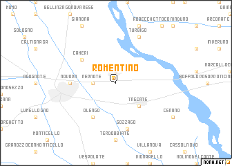
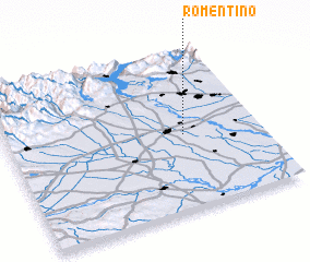
Romentino (Italy)Romentino is a town in Italy. An overview map of the region around Romentino is displayed below.
regional and 3d topo map of Romentino, Italy ::
Romentino airports ::
The nearest airport is MXP - Milano Malpensa, located 18.4 km north of Romentino.
Other airports nearby include LIN - Milan Linate (45.2 km east), LUG - Lugano (62.0 km north), BGY - Bergamo Orio Al Serio (81.7 km east), TRN - Torino (87.5 km west), Nearby towns ::
 Places with similar names to Romentino, Italy ::
// Riman Taini (NG)
// Remontnyy (RU)
Disclaimer :: Information on this page comes without warranty of any kind |
||
|
Where is Romentino? Elevation and coordinates ::
Latitude (lat): 45°28'0"N Longitude (lon): 8°42'0"E
Elevation (approx.): 148m (map arrows pan, magnifying glasses zoom) |
||
|
Visiting Romentino? Hotel/Accommodation ::
Book a hotel in Romentino Travel Guide ::
Buy a travel guide for Italy rental cars ::
car rental offers GPS waypoint ::
download a GPX waypoint (PoI) of Romentino for your GPS receiver
|
||