|
search place name
|
||
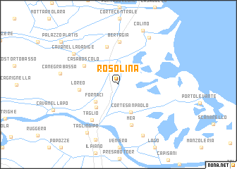
Rosolina (Veneto, Italy)Rosolina is a town in the Veneto region of Italy. An overview map of the region around Rosolina is displayed below.
regional and 3d topo map of Rosolina, Italy ::
Rosolina airports ::
The nearest airport is QPA - Padova, located 47.7 km north west of Rosolina.
Other airports nearby include VCE - Venice Venezia Tessera (48.7 km north), TSF - Treviso (64.1 km north), VIC - Vicenza (79.2 km north west), BLQ - Bologna (96.6 km south west), Nearby towns ::
Fornaci (3.8km south west) //
Corte San Paolo (4.6km south) //
Donada (4.4km south west) //
Casa Boscolo (4.9km north west) //
San Pietro di Cavarzere (6.1km north) //
Loreo (4.4km west) //
Bertagia (6.7km north) //
Mea (6.6km south) //
Taglio (6.4km south west) //
Cavanella dʼAdige (7.0km north west) //
Fossone dʼAdige (8.2km north east) //
Vallona (8.6km south) //
Taglio di Po (8.4km south west) //
Ca Lino (9.0km north) //
Rizzata (9.1km south) //
[all distances 'as the bird flies' and approximate] 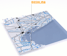 Places with similar names to Rosolina, Italy ::
Disclaimer :: Information on this page comes without warranty of any kind |
||
|
Where is Rosolina? Elevation and coordinates ::
Latitude (lat): 45°4'23"N Longitude (lon): 12°14'55"E
Elevation (approx.): -3m (map arrows pan, magnifying glasses zoom) |
||
|
Visiting Rosolina? Hotel/Accommodation ::
Book a hotel in Rosolina Travel Guide ::
Buy a travel guide for Italy rental cars ::
car rental offers GPS waypoint ::
download a GPX waypoint (PoI) of Rosolina for your GPS receiver
|
||