|
search place name
|
||
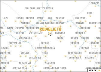
Roviglieto (Italy)Roviglieto is a town in Italy. An overview map of the region around Roviglieto is displayed below.
regional and 3d topo map of Roviglieto, Italy ::
Roviglieto airports ::
The nearest airport is PEG - Perugia, located 27.4 km north west of Roviglieto.
Other airports nearby include RMI - Rimini (121.4 km north), CIA - Rome Ciampino (126.8 km south), SAY - Siena Ampugnano (128.2 km west), PSR - Pescara (128.6 km south east), Nearby towns ::
Santo Stefano dei Piccioni (1.4km west) //
Scandolaro (1.4km west) //
Civitella (2.7km east) //
Ponze (3.3km south east) //
Matigge (3.9km south) //
Colle San Lorenzo (3.9km north) //
Uppello (3.3km north west) //
Scopoli (4.6km north east) //
Casale (4.6km north east) //
Pale (5.6km north) //
SantʼEraclio (4.1km west) //
Santa Maria in Valle (5.7km south) //
Sostino (6.2km north east) //
Vescia (6.2km north west) //
Trevi (7.5km south) //
Foligno (5.7km west) //
Pietra Rossa (6.9km south west) //
Casenove (6.6km north east) //
Pettino (8.5km south east) //
Cannaiola (8.5km south west) //
Treggio (7.8km north west) //
[all distances 'as the bird flies' and approximate]  Places with similar names to Roviglieto, Italy :: Disclaimer :: Information on this page comes without warranty of any kind |
||
|
Where is Roviglieto? Elevation and coordinates ::
Latitude (lat): 42°56'0"N Longitude (lon): 12°46'0"E
Elevation (approx.): 669m (map arrows pan, magnifying glasses zoom) |
||
|
Visiting Roviglieto? Hotel/Accommodation ::
Book a hotel in Roviglieto Travel Guide ::
Buy a travel guide for Italy rental cars ::
car rental offers GPS waypoint ::
download a GPX waypoint (PoI) of Roviglieto for your GPS receiver
|
||