|
search place name
|
||
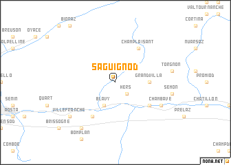
Saguignod (Italy)Saguignod is a town in Italy. An overview map of the region around Saguignod is displayed below.
regional and 3d topo map of Saguignod, Italy ::
Saguignod airports ::
The nearest airport is SIR - Sion, located 50.0 km north of Saguignod.
Other airports nearby include TRN - Torino (66.0 km south), MXP - Milano Malpensa (98.4 km east), QNJ - Annemasse (104.5 km north west), NCY - Annecy Meythet (108.7 km west), Nearby towns ::
Hers (2.3km south east) //
Blavy (3.9km south) //
Grand Villa (3.9km east) //
Marseiller (5.4km south east) //
San Marcel (6.1km south west) //
Champlaisant (6.1km north east) //
Chambave (6.4km south east) //
Villefranche (7.6km south west) //
Leutta (8.4km south west) //
[all distances 'as the bird flies' and approximate]  Places with similar names to Saguignod, Italy ::
// Schickanöd (DE)
Disclaimer :: Information on this page comes without warranty of any kind |
||
|
Where is Saguignod? Elevation and coordinates ::
Latitude (lat): 45°47'0"N Longitude (lon): 7°29'0"E
Elevation (approx.): 1335m (map arrows pan, magnifying glasses zoom) |
||
|
Visiting Saguignod? Hotel/Accommodation ::
Book a hotel in Saguignod Travel Guide ::
Buy a travel guide for Italy rental cars ::
car rental offers GPS waypoint ::
download a GPX waypoint (PoI) of Saguignod for your GPS receiver
|
||