|
search place name
|
||
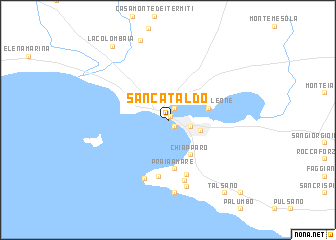
San Cataldo (Puglia, Italy)San Cataldo is a town in the Puglia region of Italy. An overview map of the region around San Cataldo is displayed below.
regional and 3d topo map of San Cataldo, Italy ::
San Cataldo airports ::
The nearest airport is TAR - Grottaglie, located 15.7 km east of San Cataldo.
Other airports nearby include BDS - Brindisi Casale (64.3 km east), LCC - Lecce (81.2 km east), BRI - Bari (83.8 km north west), CRV - Crotone (164.3 km south), Nearby towns ::
Taranto (0.4km north east) //
Città Vecchia (0.8km south east) //
Borgo (1.3km north) //
Città Nuova (2.0km east) //
Ruberto (2.9km south east) //
Chiapparo (4.4km south east) //
Casa Galeone (3.7km east) //
Praia a Mare (5.5km south) //
San Vito (6.3km south) //
Le Fontane (6.3km south) //
Villa Spartera (6.7km south) //
Gesuiti (6.9km south) //
Lama (7.7km south) //
Torre San Vito (8.1km south) //
La Batteria (9.2km north) //
Talsano (9.4km south east) //
La Colombaia (9.5km north west) //
San Donato (10.1km south east) //
[all distances 'as the bird flies' and approximate] 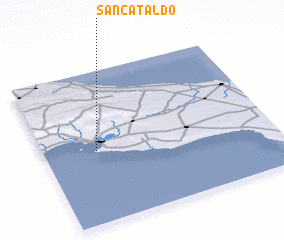 Places with similar names to San Cataldo, Italy ::
Disclaimer :: Information on this page comes without warranty of any kind |
||
|
Where is San Cataldo? Elevation and coordinates ::
Latitude (lat): 40°28'22"N Longitude (lon): 17°13'40"E
Elevation (approx.): -32768m (map arrows pan, magnifying glasses zoom) |
||
|
Visiting San Cataldo? Hotel/Accommodation ::
Book a hotel in San Cataldo Travel Guide ::
Buy a travel guide for Italy rental cars ::
car rental offers GPS waypoint ::
download a GPX waypoint (PoI) of San Cataldo for your GPS receiver
|
||