|
search place name
|
||
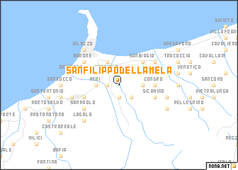
San Filippo della Mela (Italy)San Filippo della Mela is a town in Italy. An overview map of the region around San Filippo della Mela is displayed below.
regional and 3d topo map of San Filippo della Mela, Italy ::
San Filippo della Mela airports ::
The nearest airport is REG - Reggio Calabria, located 34.0 km east of San Filippo della Mela.
Other airports nearby include CTA - Catania Fontanarossa (80.0 km south), NSY - Sigonella (90.7 km south), SUF - Lamezia Terme (117.1 km north east), PMO - Palermo Boccadifalco (172.8 km west), Nearby towns ::
Olivarella (1.5km west) //
Santa Lucia del Mela (1.9km south) //
Corriolo (2.4km north west) //
Soccorso (2.4km south east) //
Merì (2.9km west) //
Pace Superiore (2.9km east) //
Santa Maria delle Grazie (3.5km north west) //
Casa Miroddi (4.0km north) //
Pace Inferiore (3.5km north east) //
San Biagio (4.7km north east) //
Condrò (4.4km east) //
San Pietro (4.7km north west) //
Sicamino (4.7km south east) //
Pozzo di Gotto (4.7km south west) //
Fondachello (5.7km north east) //
Monforte San Giorgio Marina (5.7km north east) //
Barone (5.7km north west) //
San Paolo (5.7km south west) //
Bastione (6.1km west) //
Barcellona-Pozzo di Gotto (6.1km west) //
Torregrotta (6.1km east) //
San Pier Niceto (6.1km east) //
Milazzo (7.1km north west) //
La Gala (7.1km south west) //
Case Levito (6.9km south east) //
[all distances 'as the bird flies' and approximate] 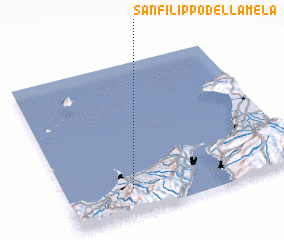 Places with similar names to San Filippo della Mela, Italy :: Disclaimer :: Information on this page comes without warranty of any kind |
||
|
Where is San Filippo della Mela? Elevation and coordinates ::
Latitude (lat): 38°10'0"N Longitude (lon): 15°17'0"E
Elevation (approx.): 127m (map arrows pan, magnifying glasses zoom) |
||
|
Visiting San Filippo della Mela? Hotel/Accommodation ::
Book a hotel in San Filippo della Mela Travel Guide ::
Buy a travel guide for Italy rental cars ::
car rental offers GPS waypoint ::
download a GPX waypoint (PoI) of San Filippo della Mela for your GPS receiver
|
||