|
search place name
|
||
Santa Brigida (Italy)Santa Brigida is a town in Italy. An overview map of the region around Santa Brigida is displayed below.
regional and 3d topo map of Santa Brigida, Italy ::

Santa Brigida airports ::
The nearest airport is BGY - Bergamo Orio Al Serio, located 35.1 km south of Santa Brigida.
Other airports nearby include LUG - Lugano (54.8 km west), SMV - Samedan (64.6 km north), LIN - Milan Linate (65.4 km south west), MXP - Milano Malpensa (79.4 km south west), Nearby towns ::
Cassiglio (1.9km south) //
Averara (1.3km east) //
Cusio (1.3km west) //
Valmoresca (1.9km north) //
Olmo al Brembo (3.2km south east) //
Ornica (3.9km west) //
Piazzatorre (3.9km east) //
Piazza Brembana (5.4km south east) //
Fraccia (6.1km north east) //
Mezzoldo (5.4km north east) //
Lenna (6.8km south east) //
Valnegra (6.3km south east) //
Fenile (9.0km north west) //
[all distances 'as the bird flies' and approximate] 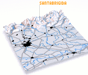 Places with similar names to Santa Brigida, Italy ::
// Saint Bridget (US)
// Santa Brígida (MX)
// Santa Brígida (BR)
// Sainte-Brigitte (FR)
// Santa Brígida (ES)
// Santa Brigida (PH)
// Santa Brigida (PH)
// Sainte-Brigitte (FR)
// Sainte-Brigitte (BE)
Disclaimer :: Information on this page comes without warranty of any kind |
||
|
Where is Santa Brigida? Elevation and coordinates ::
Latitude (lat): 45°59'0"N Longitude (lon): 9°37'0"E
Elevation (approx.): 844m (map arrows pan, magnifying glasses zoom) |
||
|
Visiting Santa Brigida? Hotel/Accommodation ::
Book a hotel in Santa Brigida Travel Guide ::
Buy a travel guide for Italy rental cars ::
car rental offers GPS waypoint ::
download a GPX waypoint (PoI) of Santa Brigida for your GPS receiver
|
||