|
search place name
|
||
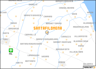
Santa Filomena (Italy)Santa Filomena is a town in Italy. An overview map of the region around Santa Filomena is displayed below.
regional and 3d topo map of Santa Filomena, Italy ::
Santa Filomena airports ::
The nearest airport is FRL - Forli, located 12.1 km south west of Santa Filomena.
Other airports nearby include RMI - Rimini (41.7 km south east), BLQ - Bologna (79.2 km north west), FLR - Firenze (93.6 km south west), QPA - Padova (130.3 km north), Nearby towns ::
San Pietro in Guardiano (3.0km south) //
Borghetto Secondo (3.0km north east) //
Borghetto Primo (3.6km north east) //
Santa Maria Nova (5.6km south) //
Campiano (5.9km north) //
Massa (4.5km north west) //
Castiglione di Ravenna (4.7km east) //
Carpinello (5.0km west) //
San Martino in Fiume (5.8km south east) //
San Pietro in Campiano (5.9km north west) //
Cannuzzo (5.5km east) //
SantʼAndrea di Rossano (6.6km south west) //
San Pietro in Vincoli (7.5km north west) //
Borgo di Ronta (8.0km south east) //
Forlimpopoli (7.8km south west) //
Fattoria Ragazzena (7.7km north east) //
[all distances 'as the bird flies' and approximate]  Places with similar names to Santa Filomena, Italy ::
// Santa Filomena (BR)
// Santa Filomena (BR)
// Santa Filomena (BR)
// Santa Filomena (BR)
// Santa Filomena (BR)
// Santa Filomena (BR)
// Santa Filomena (BR)
// Santa Filomena (BR)
// Santa Filomena (CU)
// Santa Filomena (CL)
Disclaimer :: Information on this page comes without warranty of any kind |
||
|
Where is Santa Filomena? Elevation and coordinates ::
Latitude (lat): 44°15'0"N Longitude (lon): 12°12'0"E
Elevation (approx.): 5m (map arrows pan, magnifying glasses zoom) |
||
|
Visiting Santa Filomena? Hotel/Accommodation ::
Book a hotel in Santa Filomena Travel Guide ::
Buy a travel guide for Italy rental cars ::
car rental offers GPS waypoint ::
download a GPX waypoint (PoI) of Santa Filomena for your GPS receiver
|
||