|
search place name
|
||
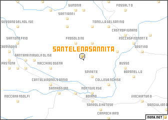
SantʼElena Sannita (Italy)SantʼElena Sannita is a town in Italy. An overview map of the region around SantʼElena Sannita is displayed below.
regional and 3d topo map of SantʼElena Sannita, Italy ::
SantʼElena Sannita airports ::
The nearest airport is NAP - Naples Capodichino, located 77.0 km south of SantʼElena Sannita.
Other airports nearby include FOG - Foggia Gino Lisa (90.4 km east), PSR - Pescara (98.9 km north), QLT - Latina (130.0 km west), CIA - Rome Ciampino (158.0 km west), Nearby towns ::
San Pietro in Valle (4.0km north) //
Frosolone (4.0km north) //
Spinete (4.0km south) //
Molise (7.5km north) //
Casalciprano (5.8km east) //
Monteverde (7.5km south) //
Castellone (7.5km south) //
Macchiagodena (5.8km west) //
Colledanchise (6.9km south east) //
Acquevive (7.9km north) //
Torella del Sannio (8.5km north east) //
Cantalupo nel Sannio (7.9km south west) //
San Massimo (8.5km south west) //
[all distances 'as the bird flies' and approximate] 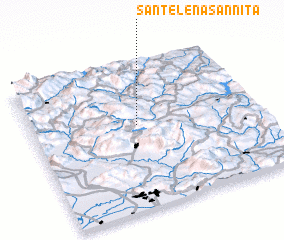 Places with similar names to SantʼElena Sannita, Italy :: Disclaimer :: Information on this page comes without warranty of any kind |
||
|
Where is SantʼElena Sannita? Elevation and coordinates ::
Latitude (lat): 41°34'0"N Longitude (lon): 14°28'0"E
Elevation (approx.): 705m (map arrows pan, magnifying glasses zoom) |
||
|
Visiting SantʼElena Sannita? Hotel/Accommodation ::
Book a hotel in SantʼElena Sannita Travel Guide ::
Buy a travel guide for Italy rental cars ::
car rental offers GPS waypoint ::
download a GPX waypoint (PoI) of SantʼElena Sannita for your GPS receiver
|
||