|
search place name
|
||
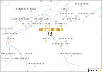
San Tommaso (Italy)San Tommaso is a town in Italy. An overview map of the region around San Tommaso is displayed below.
regional and 3d topo map of San Tommaso, Italy ::
San Tommaso airports ::
The nearest airport is PSR - Pescara, located 32.8 km north east of San Tommaso.
Other airports nearby include QLT - Latina (113.0 km south west), CIA - Rome Ciampino (121.4 km west), NAP - Naples Capodichino (146.6 km south), FCO - Rome Fiumicino (148.3 km west), Nearby towns ::
Salle (2.3km south west) //
Bolognano (4.0km north) //
Caramanico Terme (4.6km south east) //
Abbateggio (4.6km north east) //
San Valentino in Abruzzo Citeriore (5.7km north) //
Case di Contra (4.5km south east) //
Torre deʼ Passeri (6.2km north west) //
Tocco da Casauria (6.6km north west) //
Lettomanoppello (7.8km north east) //
Castiglione a Casauria (7.8km north west) //
Turrivalignani (8.5km north east) //
SantʼEufemia a Maiella (9.2km south east) //
[all distances 'as the bird flies' and approximate] 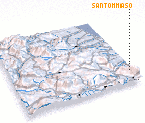 Places with similar names to San Tommaso, Italy ::
// Saint Thomas (BZ)
// Saint Thomas (US)
// San Dimas (US)
// San Tomas (US)
// Saint Thomas (US)
// Saint Thomas (US)
// San Tommaso (IT)
// San Tommaso (IT)
// San Damías (ES)
// Sandamías (ES)
Disclaimer :: Information on this page comes without warranty of any kind |
||
|
Where is San Tommaso? Elevation and coordinates ::
Latitude (lat): 42°11'0"N Longitude (lon): 13°58'0"E
Elevation (approx.): 476m (map arrows pan, magnifying glasses zoom) |
||
|
Visiting San Tommaso? Hotel/Accommodation ::
Book a hotel in San Tommaso Travel Guide ::
Buy a travel guide for Italy rental cars ::
car rental offers GPS waypoint ::
download a GPX waypoint (PoI) of San Tommaso for your GPS receiver
|
||