|
search place name
|
||
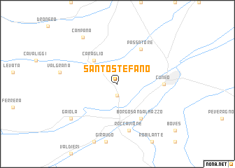
Santo Stefano (Italy)Santo Stefano is a town in Italy. An overview map of the region around Santo Stefano is displayed below.
regional and 3d topo map of Santo Stefano, Italy ::
Santo Stefano airports ::
The nearest airport is CUF - Levaldigi, located 22.0 km north east of Santo Stefano.
Other airports nearby include ALL - Albenga (64.5 km south east), NCE - Nice Cote D Azur (83.0 km south), TRN - Torino (92.0 km north), CEQ - Cannes Mandelieu (102.1 km south west), Nearby towns ::
Vignolo (1.9km south) //
Caraglio (4.6km north west) //
Borgo San Dalmazzo (6.2km south east) //
Passatore (6.2km north east) //
Cuneo (5.3km east) //
Roccavione (7.5km south) //
Gaiola (7.7km south west) //
Campana (8.4km north west) //
[all distances 'as the bird flies' and approximate]  Places with similar names to Santo Stefano, Italy ::
// Santo Stefano (IT)
// Santo Stefano (IT)
// Santo Stefano (IT)
// Santo Stefano (IT)
// Santo Stefano (IT)
// Santo Stefano (IT)
// Saint Stephen (US)
// Saint Stephen (US)
// Saint Stephen (US)
// Saint Stephen (CA)
Disclaimer :: Information on this page comes without warranty of any kind |
||
|
Where is Santo Stefano? Elevation and coordinates ::
Latitude (lat): 44°23'0"N Longitude (lon): 7°28'0"E
Elevation (approx.): 575m (map arrows pan, magnifying glasses zoom) |
||
|
Visiting Santo Stefano? Hotel/Accommodation ::
Book a hotel in Santo Stefano Travel Guide ::
Buy a travel guide for Italy rental cars ::
car rental offers GPS waypoint ::
download a GPX waypoint (PoI) of Santo Stefano for your GPS receiver
|
||