|
search place name
|
||
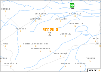
Scordia (Italy)Scordia is a town in Italy. An overview map of the region around Scordia is displayed below.
regional and 3d topo map of Scordia, Italy ::
Scordia airports ::
The nearest airport is NSY - Sigonella, located 13.0 km north east of Scordia.
Other airports nearby include CTA - Catania Fontanarossa (26.6 km north east), REG - Reggio Calabria (111.0 km north east), PMO - Palermo Boccadifalco (162.7 km north west), MLA - Malta Luqa (163.5 km south), Nearby towns ::
Case San Leo (5.6km south) //
Casa Iroldo (4.4km east) //
Militello in Val di Catania (5.8km south west) //
Masseria San Biagio (6.3km south west) //
Castellana (6.3km north east) //
Serravalle (7.1km north west) //
Francofonte (8.0km south) //
La Callura (8.0km north) //
[all distances 'as the bird flies' and approximate] 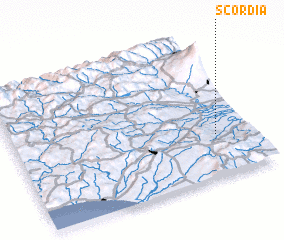 Places with similar names to Scordia, Italy ::
Disclaimer :: Information on this page comes without warranty of any kind |
||
|
Where is Scordia? Elevation and coordinates ::
Latitude (lat): 37°18'0"N Longitude (lon): 14°51'0"E
Elevation (approx.): 154m (map arrows pan, magnifying glasses zoom) |
||
|
Visiting Scordia? Hotel/Accommodation ::
Book a hotel in Scordia Travel Guide ::
Buy a travel guide for Italy rental cars ::
car rental offers GPS waypoint ::
download a GPX waypoint (PoI) of Scordia for your GPS receiver
|
||