|
search place name
|
||
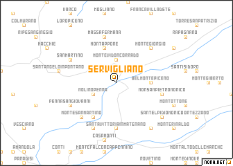
Servigliano (Italy)Servigliano is a town in Italy. An overview map of the region around Servigliano is displayed below.
regional and 3d topo map of Servigliano, Italy ::
Servigliano airports ::
The nearest airport is PEG - Perugia, located 79.0 km west of Servigliano.
Other airports nearby include PSR - Pescara (92.2 km south east), RMI - Rimini (125.7 km north west), CIA - Rome Ciampino (160.3 km south west), FRL - Forli (168.1 km north west), Nearby towns ::
Falerone (2.3km north west) //
Monte Vidon Corrado (3.7km north) //
Molino Penna (3.3km south west) //
Belmonte Piceno (4.1km east) //
San Croce (5.7km north) //
Montappone (5.7km north) //
Monte Vidon Combatte (6.2km south west) //
Santa Vittoria in Matenano (7.4km south) //
Massa Fermana (7.5km north) //
Monsampietro Morico (5.7km east) //
Montegiorgio (6.9km north east) //
Monte San Martino (6.9km south west) //
Molino (7.9km south) //
Penna San Giovanni (6.6km south west) //
San Martino (6.6km north west) //
Montelparo (8.5km south east) //
SantʼElpidio Morico (7.8km south east) //
[all distances 'as the bird flies' and approximate]  Places with similar names to Servigliano, Italy :: Disclaimer :: Information on this page comes without warranty of any kind |
||
|
Where is Servigliano? Elevation and coordinates ::
Latitude (lat): 43°5'0"N Longitude (lon): 13°29'0"E
Elevation (approx.): 190m (map arrows pan, magnifying glasses zoom) |
||
|
Visiting Servigliano? Hotel/Accommodation ::
Book a hotel in Servigliano Travel Guide ::
Buy a travel guide for Italy rental cars ::
car rental offers GPS waypoint ::
download a GPX waypoint (PoI) of Servigliano for your GPS receiver
|
||