|
search place name
|
||
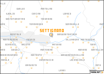
Settignano (Italy)Settignano is a town in Italy. An overview map of the region around Settignano is displayed below.
regional and 3d topo map of Settignano, Italy ::
nearby GPS traces from timatio ::
Settignano airports ::
The nearest airport is FLR - Firenze, located 9.5 km west of Settignano.
Other airports nearby include SAY - Siena Ampugnano (58.8 km south), PSA - Pisa (75.2 km west), FRL - Forli (75.8 km north east), BLQ - Bologna (83.6 km north), Nearby towns ::
Casellina (2.3km south west) //
Borgunto (2.3km north west) //
Bagno a Ripoli (3.7km south) //
Paterno (3.9km south) //
Fiesole (3.3km north west) //
Compiobbi (4.0km east) //
San Donato a Torri (4.0km east) //
Antella (5.6km south) //
Trespiano (5.7km north) //
Ponte a Ema (5.7km south) //
Terra Rossa (5.5km north west) //
Villamagna (5.7km east) //
Firenze (5.7km west) //
Serravalle (6.5km north east) //
Grassina (7.9km south) //
Montauto (8.4km south west) //
LʼOpaco (8.4km north east) //
Castiglione (8.4km north west) //
Cercina (8.4km north west) //
San Donato in Collina (9.1km south east) //
[all distances 'as the bird flies' and approximate] 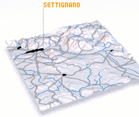
Disclaimer :: Information on this page comes without warranty of any kind |
||
|
Where is Settignano? Elevation and coordinates ::
Latitude (lat): 43°47'0"N Longitude (lon): 11°19'0"E
Elevation (approx.): 128m (map arrows pan, magnifying glasses zoom) |
||
|
Visiting Settignano? Hotel/Accommodation ::
Book a hotel in Settignano Travel Guide ::
Buy a travel guide for Italy rental cars ::
car rental offers GPS waypoint ::
download a GPX waypoint (PoI) of Settignano for your GPS receiver
|
||