|
search place name
|
||
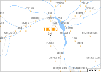
Tuenno (Italy)Tuenno is a town in Italy. An overview map of the region around Tuenno is displayed below.
regional and 3d topo map of Tuenno, Italy ::
Tuenno airports ::
The nearest airport is BZO - Bolzano, located 27.7 km north east of Tuenno.
Other airports nearby include SMV - Samedan (89.9 km west), VIC - Vicenza (93.4 km south east), VRN - Villafranca (104.7 km south), INN - Innsbruck (106.0 km north), Nearby towns ::
Flavon (3.7km south) //
Cles (3.9km north) //
Scanna (5.6km north) //
Dermulo (3.8km east) //
Tassullo (3.8km east) //
Revò (6.1km north east) //
Sanzeno (5.3km north east) //
Livo (7.4km north) //
Coredo (5.4km east) //
Bordiana (6.8km north west) //
Denno (7.8km south) //
Cassana (6.3km north west) //
[all distances 'as the bird flies' and approximate] 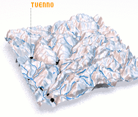 Places with similar names to Tuenno, Italy ::
Disclaimer :: Information on this page comes without warranty of any kind |
||
|
Where is Tuenno? Elevation and coordinates ::
Latitude (lat): 46°20'0"N Longitude (lon): 11°1'0"E
Elevation (approx.): 739m (map arrows pan, magnifying glasses zoom) |
||
|
Visiting Tuenno? Hotel/Accommodation ::
Book a hotel in Tuenno Travel Guide ::
Buy a travel guide for Italy rental cars ::
car rental offers GPS waypoint ::
download a GPX waypoint (PoI) of Tuenno for your GPS receiver
|
||