|
search place name
|
||
Valmaggiore (Italy)Valmaggiore is a town in Italy. An overview map of the region around Valmaggiore is displayed below.
regional and 3d topo map of Valmaggiore, Italy ::

Valmaggiore airports ::
The nearest airport is FRL - Forli, located 36.9 km east of Valmaggiore.
Other airports nearby include FLR - Firenze (48.8 km south west), BLQ - Bologna (51.8 km north west), RMI - Rimini (80.7 km east), SAY - Siena Ampugnano (101.7 km south), Nearby towns ::
La Valle (1.9km north) //
Castagno (3.2km north west) //
Mercatale (4.6km north west) //
Canovello (6.2km south east) //
SantʼAdriano (5.4km south east) //
Marradi (7.4km south) //
San Cassiano (5.6km east) //
Palazzuolo sul Senio (5.6km west) //
Salecchio (6.5km south west) //
Sommorio (6.5km north west) //
La Strada (7.7km north east) //
[all distances 'as the bird flies' and approximate] 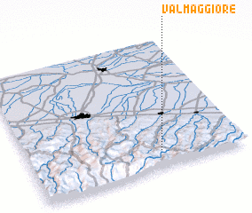 Places with similar names to Valmaggiore, Italy ::
// Valea Măgurii (RO)
// Valea Măgurii (RO)
// Ghulām Kirio (PK)
// Valmaggiore (IT)
// Villa Magri (IT)
// Villa Maggiore (IT)
// Villamaggiore (IT)
// Vilmaggiore (IT)
Disclaimer :: Information on this page comes without warranty of any kind |
||
|
Where is Valmaggiore? Elevation and coordinates ::
Latitude (lat): 44°8'0"N Longitude (lon): 11°37'0"E
Elevation (approx.): 577m (map arrows pan, magnifying glasses zoom) |
||
|
Visiting Valmaggiore? Hotel/Accommodation ::
Book a hotel in Valmaggiore Travel Guide ::
Buy a travel guide for Italy rental cars ::
car rental offers GPS waypoint ::
download a GPX waypoint (PoI) of Valmaggiore for your GPS receiver
|
||