|
search place name
|
||
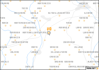
Vo (Italy)Vo is a town in Italy. An overview map of the region around Vo is displayed below.
regional and 3d topo map of Vo, Italy ::
Vo airports ::
The nearest airport is VIC - Vicenza, located 15.6 km north east of Vo.
Other airports nearby include QPA - Padova (33.0 km east), VRN - Villafranca (43.1 km west), TSF - Treviso (63.4 km east), VCE - Venice Venezia Tessera (72.1 km east), Nearby towns ::
SantʼAntonio (2.3km south west) //
Brendola (2.3km north east) //
La Gualda (3.2km north west) //
Montebello Vicentino (3.9km west) //
Perarolo (4.3km north east) //
Spiazzo (5.7km south) //
Montecchio Maggiore (6.1km north west) //
Zermeghedo (5.5km west) //
Valle (6.8km north west) //
Ponte (6.8km south west) //
Fimon (6.4km north east) //
Zovencedo (6.4km south east) //
Altavilla Vicentina (7.9km north) //
Villa del Ferro (7.9km south) //
Covolo (8.4km north west) //
Lonigo (8.4km south west) //
Toara (9.1km south east) //
[all distances 'as the bird flies' and approximate] 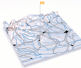 Places with similar names to Vo, Italy ::
Disclaimer :: Information on this page comes without warranty of any kind |
||
|
Where is Vo? Elevation and coordinates ::
Latitude (lat): 45°27'0"N Longitude (lon): 11°26'0"E
Elevation (approx.): 39m (map arrows pan, magnifying glasses zoom) |
||
|
Visiting Vo? Hotel/Accommodation ::
Book a hotel in Vo Travel Guide ::
Buy a travel guide for Italy rental cars ::
car rental offers GPS waypoint ::
download a GPX waypoint (PoI) of Vo for your GPS receiver
|
||