|
search place name
|
||
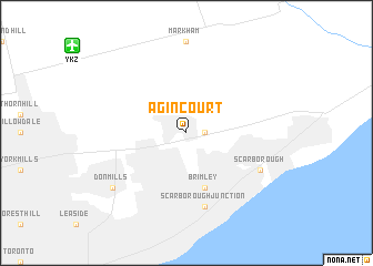
Agincourt (Ontario, Canada)Agincourt is a town in the Ontario region of Canada. An overview map of the region around Agincourt is displayed below.
regional and 3d topo map of Agincourt, Canada ::
Agincourt airports ::
The nearest airport is YKZ - Toronto Buttonville Muni, located 12.1 km north west of Agincourt.
Other airports nearby include YZD - Toronto Downsview (16.6 km west), YTZ - Toronto City Centre (20.2 km south west), YYZ - Toronto Lester B Pearson Intl (31.6 km west), IAG - Niagara Falls Intl (79.5 km south), Nearby towns ::
Scarborough Township (1.3km east) //
Brimley (5.7km south) //
Scarborough Junction (7.5km south) //
Scarborough (6.5km south east) //
Don Mills (7.7km south west) //
[all distances 'as the bird flies' and approximate] 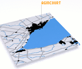 Places with similar names to Agincourt, Canada ::
Disclaimer :: Information on this page comes without warranty of any kind |
||
|
Where is Agincourt? Elevation and coordinates ::
Latitude (lat): 43°47'0"N Longitude (lon): 79°16'0"W
Elevation (approx.): 175m (map arrows pan, magnifying glasses zoom) |
||
|
Visiting Agincourt? Hotel/Accommodation ::
Book a hotel in Agincourt Travel Guide ::
Buy a travel guide for Canada rental cars ::
car rental offers GPS waypoint ::
download a GPX waypoint (PoI) of Agincourt for your GPS receiver
|
||