|
search place name
|
||
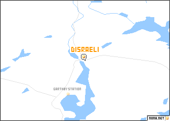
Disraeli (Québec, Canada)Disraeli is a town in the Québec region of Canada. An overview map of the region around Disraeli is displayed below.
regional and 3d topo map of Disraeli, Canada ::
Disraeli airports ::
The nearest airport is YSC - Sherbrooke, located 57.8 km south west of Disraeli.
Other airports nearby include YQB - Quebec Jean Lesage Intl (99.1 km north), YJN - St. Jean St Jean (165.0 km south west), BTV - Burlington Intl (212.8 km south west), YRI - Riviere Du Loup (247.2 km north east), Nearby towns ::
Garthby Station (7.8km south) //
[all distances 'as the bird flies' and approximate] 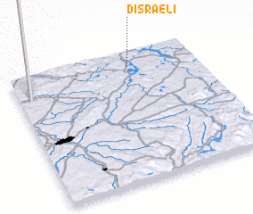 Places with similar names to Disraeli, Canada ::
// Dosu Rîului (RO)
// Tacirli (TR)
// Tecirli (TR)
// Tasaral (KZ)
// Tasirla (GN)
// Dossorola (ML)
// Tésséréla (ML)
// Doussarelle (FR)
// Dzirula (GE)
// Dzirula (GE)
Disclaimer :: Information on this page comes without warranty of any kind |
||
|
Where is Disraeli? Elevation and coordinates ::
Latitude (lat): 45°54'0"N Longitude (lon): 71°21'0"W
Elevation (approx.): 254m (map arrows pan, magnifying glasses zoom) |
||
|
Visiting Disraeli? Hotel/Accommodation ::
Book a hotel in Disraeli Travel Guide ::
Buy a travel guide for Canada rental cars ::
car rental offers GPS waypoint ::
download a GPX waypoint (PoI) of Disraeli for your GPS receiver
|
||