|
search place name
|
||
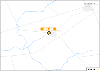
Ingersoll (Ontario, Canada)Ingersoll is a town in the Ontario region of Canada. An overview map of the region around Ingersoll is displayed below.
regional and 3d topo map of Ingersoll, Canada ::
Ingersoll airports ::
The nearest airport is YXU - London, located 22.1 km west of Ingersoll.
Other airports nearby include YKF - Waterloo (62.7 km north east), YHM - Hamilton (78.8 km east), YZR - Sarnia Chris Hadfield (116.3 km west), YYZ - Toronto Lester B Pearson Intl (124.2 km north east), Nearby towns ::
[all distances 'as the bird flies' and approximate]  Places with similar names to Ingersoll, Canada ::
Disclaimer :: Information on this page comes without warranty of any kind |
||
|
Where is Ingersoll? Elevation and coordinates ::
Latitude (lat): 43°2'0"N Longitude (lon): 80°53'0"W
Elevation (approx.): 293m (map arrows pan, magnifying glasses zoom) |
||
|
Visiting Ingersoll? Hotel/Accommodation ::
Book a hotel in Ingersoll Travel Guide ::
Buy a travel guide for Canada rental cars ::
car rental offers GPS waypoint ::
download a GPX waypoint (PoI) of Ingersoll for your GPS receiver
|
||