|
search place name
|
||
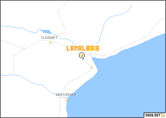
La Malbaie (Québec, Canada)La Malbaie is a town in the Québec region of Canada. An overview map of the region around La Malbaie is displayed below.
regional and 3d topo map of La Malbaie, Canada ::
nearby GPS traces from timatio ::
La Malbaie airports ::
The nearest airport is YRI - Riviere Du Loup, located 45.5 km east of La Malbaie.
Other airports nearby include YBG - Bagotville (97.8 km north west), YQB - Quebec Jean Lesage Intl (133.2 km south west), YYY - Mont Joli (180.6 km north east), YBC - Baie Comeau (219.7 km north east), Nearby towns ::
Pointe-au-Pic (2.2km south east) //
Clermont (6.2km north west) //
[all distances 'as the bird flies' and approximate]  Places with similar names to La Malbaie, Canada ::
Disclaimer :: Information on this page comes without warranty of any kind |
||
|
Where is La Malbaie? Elevation and coordinates ::
Latitude (lat): 47°39'0"N Longitude (lon): 70°10'0"W
Elevation (approx.): 73m (map arrows pan, magnifying glasses zoom) |
||
|
Visiting La Malbaie? Hotel/Accommodation ::
Book a hotel in La Malbaie Travel Guide ::
Buy a travel guide for Canada rental cars ::
car rental offers GPS waypoint ::
download a GPX waypoint (PoI) of La Malbaie for your GPS receiver
|
||