|
search place name
|
||
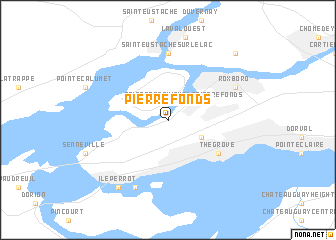
Pierrefonds (Québec, Canada)Pierrefonds is a town in the Québec region of Canada. An overview map of the region around Pierrefonds is displayed below.
regional and 3d topo map of Pierrefonds, Canada ::
Pierrefonds airports ::
The nearest airport is YUL - Montreal Pierre Elliott Trudeau Intl, located 11.2 km east of Pierrefonds.
Other airports nearby include YMX - Montreal Intl Mirabel (26.6 km north west), YHU - Montreal St Hubert (36.9 km east), YJN - St. Jean St Jean (50.9 km east), MSS - Massena Intl Richards Fld (95.9 km south west), Nearby towns ::
Sainte-Geneviève-de-Pierrefonds (2.3km north east) //
Sainte-Anne-de-Bellevue (2.3km north west) //
Dollard-des-Ormeaux (3.2km south east) //
The Grove (5.4km south east) //
Beaconsfield (5.4km south east) //
Saint-Eustache-sur-le-Lac (7.4km north) //
Roxboro (6.4km north east) //
Baie-dʼUrfé (7.9km south) //
Île-Perrot (8.4km south west) //
Sainte-Dorothée (9.1km north east) //
[all distances 'as the bird flies' and approximate]  Places with similar names to Pierrefonds, Canada ::
Disclaimer :: Information on this page comes without warranty of any kind |
||
|
Where is Pierrefonds? Elevation and coordinates ::
Latitude (lat): 45°28'0"N Longitude (lon): 73°53'0"W
Elevation (approx.): 28m (map arrows pan, magnifying glasses zoom) |
||
|
Visiting Pierrefonds? Hotel/Accommodation ::
Book a hotel in Pierrefonds Travel Guide ::
Buy a travel guide for Canada rental cars ::
car rental offers GPS waypoint ::
download a GPX waypoint (PoI) of Pierrefonds for your GPS receiver
|
||