|
search place name
|
||
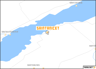
Saint-Anicet (Québec, Canada)Saint-Anicet is a town in the Québec region of Canada. An overview map of the region around Saint-Anicet is displayed below.
regional and 3d topo map of Saint-Anicet, Canada ::
Saint-Anicet airports ::
The nearest airport is MSS - Massena Intl Richards Fld, located 44.8 km south west of Saint-Anicet.
Other airports nearby include YUL - Montreal Pierre Elliott Trudeau Intl (60.7 km north east), YMX - Montreal Intl Mirabel (65.4 km north), YHU - Montreal St Hubert (84.7 km north east), YJN - St. Jean St Jean (85.9 km east), Nearby towns ::
[all distances 'as the bird flies' and approximate]  Places with similar names to Saint-Anicet, Canada ::
// Sinaton East (MY)
// Sundneset (NO)
// Sandnäset (SE)
// Sandnäset (SE)
// Sandnäset (SE)
// Sandnäsudd (FI)
Disclaimer :: Information on this page comes without warranty of any kind |
||
|
Where is Saint-Anicet? Elevation and coordinates ::
Latitude (lat): 45°8'0"N Longitude (lon): 74°21'0"W
Elevation (approx.): 47m (map arrows pan, magnifying glasses zoom) |
||
|
Visiting Saint-Anicet? Hotel/Accommodation ::
Book a hotel in Saint-Anicet Travel Guide ::
Buy a travel guide for Canada rental cars ::
car rental offers GPS waypoint ::
download a GPX waypoint (PoI) of Saint-Anicet for your GPS receiver
|
||