|
search place name
|
||
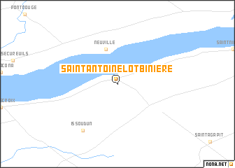
Saint-Antoine-Lotbinière (Québec, Canada)Saint-Antoine-Lotbinière is a town in the Québec region of Canada. An overview map of the region around Saint-Antoine-Lotbinière is displayed below.
regional and 3d topo map of Saint-Antoine-Lotbinière, Canada ::
Saint-Antoine-Lotbinière airports ::
The nearest airport is YQB - Quebec Jean Lesage Intl, located 20.5 km north east of Saint-Antoine-Lotbinière.
Other airports nearby include YSC - Sherbrooke (135.0 km south), YHU - Montreal St Hubert (190.6 km south west), YBG - Bagotville (191.7 km north), YRI - Riviere Du Loup (194.7 km north east), Nearby towns ::
 Places with similar names to Saint-Antoine-Lotbinière, Canada :: Disclaimer :: Information on this page comes without warranty of any kind |
||
|
Where is Saint-Antoine-Lotbinière? Elevation and coordinates ::
Latitude (lat): 46°39'0"N Longitude (lon): 71°34'0"W
Elevation (approx.): 67m (map arrows pan, magnifying glasses zoom) |
||
|
Visiting Saint-Antoine-Lotbinière? Hotel/Accommodation ::
Book a hotel in Saint-Antoine-Lotbinière Travel Guide ::
Buy a travel guide for Canada rental cars ::
car rental offers GPS waypoint ::
download a GPX waypoint (PoI) of Saint-Antoine-Lotbinière for your GPS receiver
|
||