|
search place name
|
||
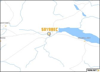
Sayabec (Québec, Canada)Sayabec is a town in the Québec region of Canada. An overview map of the region around Sayabec is displayed below.
regional and 3d topo map of Sayabec, Canada ::
Sayabec airports ::
The nearest airport is YYY - Mont Joli, located 39.3 km west of Sayabec.
Other airports nearby include YBC - Baie Comeau (75.2 km north west), YCL - Charlo (118.1 km south east), YRI - Riviere Du Loup (166.2 km south west), CAR - Caribou Muni (188.3 km south), Nearby towns ::
[all distances 'as the bird flies' and approximate]  Places with similar names to Sayabec, Canada ::
Disclaimer :: Information on this page comes without warranty of any kind |
||
|
Where is Sayabec? Elevation and coordinates ::
Latitude (lat): 48°33'0"N Longitude (lon): 67°41'0"W
Elevation (approx.): 177m (map arrows pan, magnifying glasses zoom) |
||
|
Visiting Sayabec? Hotel/Accommodation ::
Book a hotel in Sayabec Travel Guide ::
Buy a travel guide for Canada rental cars ::
car rental offers GPS waypoint ::
download a GPX waypoint (PoI) of Sayabec for your GPS receiver
|
||