|
search place name
|
||
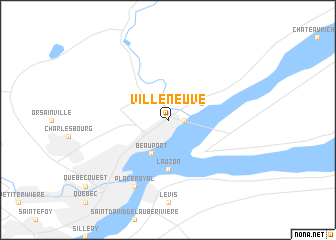
Villeneuve (Québec, Canada)Villeneuve is a town in the Québec region of Canada. An overview map of the region around Villeneuve is displayed below.
regional and 3d topo map of Villeneuve, Canada ::
nearby GPS traces from timatio ::
Villeneuve airports ::
The nearest airport is YQB - Quebec Jean Lesage Intl, located 20.1 km south west of Villeneuve.
Other airports nearby include YRI - Riviere Du Loup (154.6 km north east), YBG - Bagotville (161.4 km north), YSC - Sherbrooke (165.6 km south), YRJ - Roberval (199.8 km north west), Nearby towns ::
Montmorency (1.3km east) //
Courville (1.3km east) //
Beauport (3.9km south) //
Saint-Jean-de-Boischâtel (3.1km north east) //
Lauzon (5.6km south) //
Place Royal (7.8km south) //
[all distances 'as the bird flies' and approximate] 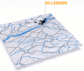 Places with similar names to Villeneuve, Canada ::
// Val'nëvo (RU)
// Villa Nueva (BO)
// Villa Nueva (BO)
// Villa Nueva (BO)
// Volynovo (RU)
// Vila Nova (PT)
// Vila Nova (PT)
// Vila Nova (PT)
// Vila Nova (PT)
// Vila Nova (PT)
Disclaimer :: Information on this page comes without warranty of any kind |
||
|
Where is Villeneuve? Elevation and coordinates ::
Latitude (lat): 46°53'0"N Longitude (lon): 71°10'0"W
Elevation (approx.): 106m (map arrows pan, magnifying glasses zoom) |
||
|
Visiting Villeneuve? Hotel/Accommodation ::
Book a hotel in Villeneuve Travel Guide ::
Buy a travel guide for Canada rental cars ::
car rental offers GPS waypoint ::
download a GPX waypoint (PoI) of Villeneuve for your GPS receiver
|
||