|
search place name
|
||
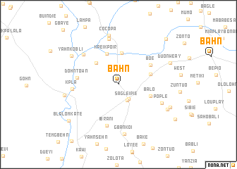
Bahn (Nimba, Liberia)Bahn is a town in the Nimba region of Liberia. An overview map of the region around Bahn is displayed below.
regional and 3d topo map of Bahn, Liberia ::
Bahn airports ::
The nearest airport is MJC - Man, located 143.3 km east of Bahn.
Other airports nearby include ROB - Monrovia Roberts Intl (186.5 km south west), MLW - Monrovia Spriggs Payne (224.4 km west), Nearby towns ::
Karnwee (2.8km south east) //
Sagleipie (2.9km south east) //
Buntin (4.9km north west) //
Karnwee (5.0km north) //
Beti (5.1km north) //
Kpeikpoir (5.2km north) //
Sam Do Town (5.3km east) //
Balo (5.4km east) //
Boe (5.9km north east) //
Dohn Town (6.6km west) //
Ibrani (6.8km south) //
Bampa Town (7.3km north west) //
Kpla (7.3km west) //
Yasono (7.4km north) //
Pople (7.4km south east) //
Cocopa (7.9km north) //
Gbankoi (7.9km south) //
Zeple (8.6km south east) //
Yahn Kobli (8.7km north west) //
Zahn (8.6km west) //
Duonweay (8.8km north east) //
Tropoe (8.9km south east) //
Blalomkate (9.7km south west) //
Zolopa (10.4km north east) //
Gbaye (12.2km north west) //
[all distances 'as the bird flies' and approximate] 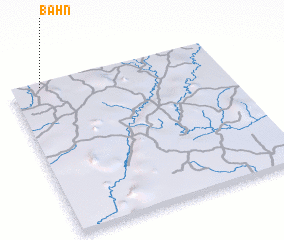 Places with similar names to Bahn, Liberia ::
Disclaimer :: Information on this page comes without warranty of any kind |
||
|
Where is Bahn? Elevation and coordinates ::
Latitude (lat): 6°59'7"N Longitude (lon): 8°51'10"W
Elevation (approx.): 252m (map arrows pan, magnifying glasses zoom) |
||
|
Visiting Bahn? Hotel/Accommodation ::
Book a hotel in Bahn Travel Guide ::
Buy a travel guide for Liberia rental cars ::
car rental offers GPS waypoint ::
download a GPX waypoint (PoI) of Bahn for your GPS receiver
|
||