|
search place name
|
||
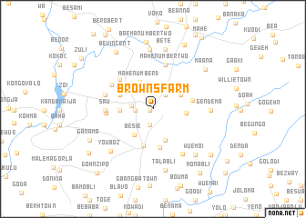
Browns Farm (Bomi, Liberia)Browns Farm is a town in the Bomi region of Liberia. An overview map of the region around Browns Farm is displayed below.
regional and 3d topo map of Browns Farm, Liberia ::
Browns Farm airports ::
The nearest airport is MLW - Monrovia Spriggs Payne, located 50.6 km south of Browns Farm.
Other airports nearby include ROB - Monrovia Roberts Intl (78.4 km south east), Nearby towns ::
Bie Kende (0.4km west) //
Sakue (2.0km south) //
Jawajei (2.2km west) //
Balaka (2.3km north east) //
Gaya Hills (2.6km west) //
Be Gole (3.4km north east) //
Mahe Number 1 (3.7km north west) //
Voke (3.8km north east) //
Be Sie (3.9km south west) //
Kamo Farm (4.0km west) //
Joyce Brown Village (4.1km south) //
Biesua (4.1km east) //
Gbamgbama (4.4km north west) //
Klay (4.7km south) //
Fali (4.9km south) //
Bamazo (4.9km east) //
Gondama (5.4km north west) //
Kava (5.6km north) //
Mahe Number Two (5.6km north) //
Besau (5.7km west) //
Jiahea (5.9km north west) //
Sau (5.9km west) //
Jiema (5.9km west) //
Wueditai (6.1km west) //
Be Momodi (6.5km south east) //
Domagbe (7.0km east) //
Gendema (7.0km east) //
Baema Number One (7.3km north) //
Youboz (7.3km south west) //
[all distances 'as the bird flies' and approximate] 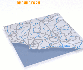 Places with similar names to Browns Farm, Liberia ::
// Browns Farm (US)
Disclaimer :: Information on this page comes without warranty of any kind |
||
|
Where is Browns Farm? Elevation and coordinates ::
Latitude (lat): 6°44'4"N Longitude (lon): 10°51'49"W
Elevation (approx.): 63m (map arrows pan, magnifying glasses zoom) |
||
|
Visiting Browns Farm? Hotel/Accommodation ::
Book a hotel in Browns Farm Travel Guide ::
Buy a travel guide for Liberia rental cars ::
car rental offers GPS waypoint ::
download a GPX waypoint (PoI) of Browns Farm for your GPS receiver
|
||