|
search place name
|
||
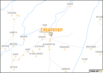
Chewreken (Grand Kru, Liberia)Chewreken is a town in the Grand Kru region of Liberia. An overview map of the region around Chewreken is displayed below.
regional and 3d topo map of Chewreken, Liberia ::
Chewreken airports ::
The nearest airport is SPY - San Pedro, located 167.9 km east of Chewreken.
Other airports nearby include DJO - Daloa (275.7 km north east), Nearby towns ::
Geetugbaken (1.1km south west) //
Wloplukehn (1.7km south) //
Tawlokehn (2.6km west) //
Gweken (3.4km north east) //
Seaken (3.6km west) //
Wlokehn Two (3.9km south) //
Tebu (4.2km north west) //
Dayokehn (4.8km south) //
Jlateken (6.3km south west) //
Jebokehn (6.4km south west) //
Pawokehn (6.7km south east) //
Wloken Number One (8.6km south west) //
Planplanken (9.1km south west) //
Wase (10.3km south west) //
[all distances 'as the bird flies' and approximate] 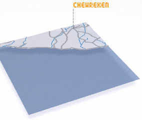 Places with similar names to Chewreken, Liberia ::
// Tiourguine (MA)
// Shahrakkān (BH)
// Shirokino (UA)
// Charcón (ES)
// Cherkino (RU)
// Churkin (RU)
// Churkina (RU)
// Churkino (RU)
// Churkino (RU)
// Churkino (RU)
Disclaimer :: Information on this page comes without warranty of any kind |
||
|
Where is Chewreken? Elevation and coordinates ::
Latitude (lat): 4°57'32"N Longitude (lon): 8°9'34"W
Elevation (approx.): 93m (map arrows pan, magnifying glasses zoom) |
||
|
Visiting Chewreken? Hotel/Accommodation ::
Book a hotel in Chewreken Travel Guide ::
Buy a travel guide for Liberia rental cars ::
car rental offers GPS waypoint ::
download a GPX waypoint (PoI) of Chewreken for your GPS receiver
|
||