|
search place name
|
||
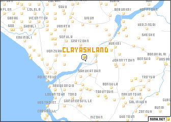
Clay Ashland (Montserrado, Liberia)Clay Ashland is a town in the Montserrado region of Liberia. An overview map of the region around Clay Ashland is displayed below.
regional and 3d topo map of Clay Ashland, Liberia ::
Clay Ashland airports ::
The nearest airport is MLW - Monrovia Spriggs Payne, located 15.2 km south of Clay Ashland.
Other airports nearby include ROB - Monrovia Roberts Intl (45.2 km south east), Nearby towns ::
Sasstown Louisiana (2.3km east) //
Louisiana Fendel (2.6km north east) //
Samuka Town (3.2km south) //
Caldwell (3.5km south) //
Grayzohn (3.8km north) //
Virginia (4.7km west) //
Chase Town (4.8km west) //
Babu Town (4.8km west) //
Bayo Town (5.3km south) //
Dixville (5.3km south west) //
Walker Town (5.5km north east) //
Jiro Town (6.0km north east) //
Kaba Town (6.0km south) //
Sefula (6.0km north west) //
Greene Town (6.3km south) //
Bakoi Town (6.3km south) //
Dandawailo (6.3km south) //
Banersville (6.3km south) //
Jesse Town (6.4km east) //
Brewerville (6.5km west) //
Vonzuahn (6.5km west) //
Dupa Town (6.9km east) //
Natrina (6.9km west) //
White Plains (7.0km north east) //
Wuekai (7.1km north east) //
White Plains (7.1km north east) //
Robertsville (7.4km east) //
Massaquoi Town (7.6km north west) //
Millsburg (7.7km north east) //
[all distances 'as the bird flies' and approximate]  Places with similar names to Clay Ashland, Liberia :: Disclaimer :: Information on this page comes without warranty of any kind |
||
|
Where is Clay Ashland? Elevation and coordinates ::
Latitude (lat): 6°25'21"N Longitude (lon): 10°43'29"W
Elevation (approx.): 10m (map arrows pan, magnifying glasses zoom) |
||
|
Visiting Clay Ashland? Hotel/Accommodation ::
Book a hotel in Clay Ashland Travel Guide ::
Buy a travel guide for Liberia rental cars ::
car rental offers GPS waypoint ::
download a GPX waypoint (PoI) of Clay Ashland for your GPS receiver
|
||