|
search place name
|
||
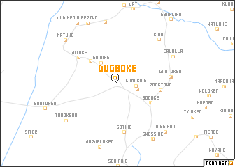
Dugboke (Maryland, Liberia)Dugboke is a town in the Maryland region of Liberia. An overview map of the region around Dugboke is displayed below.
regional and 3d topo map of Dugboke, Liberia ::
Dugboke airports ::
The nearest airport is SPY - San Pedro, located 142.3 km east of Dugboke.
Other airports nearby include DJO - Daloa (259.3 km north east), Nearby towns ::
Camp King (3.0km east) //
Glofaken (3.3km east) //
Gbaake (4.2km north west) //
Gesanke (5.6km north west) //
Sodoke (6.3km south east) //
Rock Town (6.9km east) //
Gotuke (7.4km north west) //
Sotike (7.9km south) //
Gwotuken (8.6km east) //
Bawolobo (8.7km east) //
Kana (9.6km north east) //
Tarokehn (10.1km south west) //
Matuke (10.8km north west) //
Wissikan (10.9km south east) //
[all distances 'as the bird flies' and approximate] 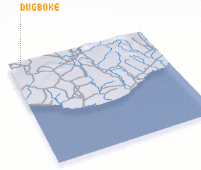 Places with similar names to Dugboke, Liberia ::
// Dagubek (PH)
// Dağbağ (TR)
// Dukubaka (GH)
// Digobuke (TZ)
// Dāki Baihk (PK)
// Doga Baihk (PK)
// Digabougou (ML)
// Dokabougou (ML)
// Dokobougou (ML)
// Tigabougou (ML)
Disclaimer :: Information on this page comes without warranty of any kind |
||
|
Where is Dugboke? Elevation and coordinates ::
Latitude (lat): 4°57'14"N Longitude (lon): 7°55'36"W
Elevation (approx.): 131m (map arrows pan, magnifying glasses zoom) |
||
|
Visiting Dugboke? Hotel/Accommodation ::
Book a hotel in Dugboke Travel Guide ::
Buy a travel guide for Liberia rental cars ::
car rental offers GPS waypoint ::
download a GPX waypoint (PoI) of Dugboke for your GPS receiver
|
||