|
search place name
|
||
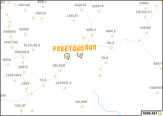
Freetown (Nimba, Liberia)Freetown is a town in the Nimba region of Liberia. An overview map of the region around Freetown is displayed below.
regional and 3d topo map of Freetown, Liberia ::
Freetown airports ::
The nearest airport is MJC - Man, located 130.9 km north east of Freetown.
Other airports nearby include ROB - Monrovia Roberts Intl (197.1 km west), Nearby towns ::
Towe (1.4km north) //
Free Town (3.0km west) //
Blako (4.7km north) //
Old Town (5.0km south east) //
Yole (5.6km east) //
Yoli (5.7km south east) //
Gblazio (5.7km south west) //
Doblu (6.0km north east) //
Sale (7.2km east) //
Zatu (7.3km south west) //
Jesseple (7.9km south west) //
Paple (8.5km north east) //
Lorlay (8.9km north) //
Yile (10.6km south west) //
[all distances 'as the bird flies' and approximate] 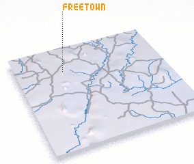 Places with similar names to Freetown, Liberia ::
Disclaimer :: Information on this page comes without warranty of any kind |
||
|
Where is Freetown? Elevation and coordinates ::
Latitude (lat): 6°47'0"N Longitude (lon): 8°40'0"W
Elevation (approx.): 298m (map arrows pan, magnifying glasses zoom) |
||
|
Visiting Freetown? Hotel/Accommodation ::
Book a hotel in Freetown Travel Guide ::
Buy a travel guide for Liberia rental cars ::
car rental offers GPS waypoint ::
download a GPX waypoint (PoI) of Freetown for your GPS receiver
|
||