|
search place name
|
||
Kakabli (Grand Bassa, Liberia)Kakabli is a town in the Grand Bassa region of Liberia. An overview map of the region around Kakabli is displayed below.
regional and 3d topo map of Kakabli, Liberia ::

Kakabli airports ::
The nearest airport is ROB - Monrovia Roberts Intl, located 52.4 km north west of Kakabli.
Other airports nearby include MLW - Monrovia Spriggs Payne (95.6 km west), Nearby towns ::
Zazohn (0.6km south) //
Greenbli (2.6km south east) //
Bayobli (2.6km north west) //
Bonkalo (3.3km south west) //
Topo (3.7km east) //
Ben Johnsonbli (3.7km east) //
Buabli (3.7km south) //
Bloso (3.7km west) //
James Weabli (4.1km south east) //
Puebabli (4.1km south east) //
Pamobli (4.1km south east) //
Gue (4.1km north west) //
Sayekohn (4.1km north west) //
Bonwein (4.3km west) //
Wabehn (4.6km east) //
Macreekbli (4.6km south east) //
Juwah Town (4.8km north west) //
Molebli (5.2km south east) //
Bowebli (5.2km south east) //
Saukobli (5.2km south east) //
Jessebli (5.2km north east) //
Faubli (5.6km south) //
Gbi (5.5km west) //
Sorrybli (5.8km east) //
Kaplubli (5.8km east) //
Blebli (5.8km east) //
Danobli (5.9km south) //
Padmorebli (5.9km south) //
Jimmybli (5.8km west) //
[all distances 'as the bird flies' and approximate] 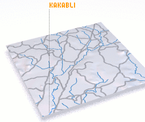 Places with similar names to Kakabli, Liberia ::
Disclaimer :: Information on this page comes without warranty of any kind |
||
|
Where is Kakabli? Elevation and coordinates ::
Latitude (lat): 6°2'0"N Longitude (lon): 9°56'0"W
Elevation (approx.): 66m (map arrows pan, magnifying glasses zoom) |
||
|
Visiting Kakabli? Hotel/Accommodation ::
Book a hotel in Kakabli Travel Guide ::
Buy a travel guide for Liberia rental cars ::
car rental offers GPS waypoint ::
download a GPX waypoint (PoI) of Kakabli for your GPS receiver
|
||