|
search place name
|
||
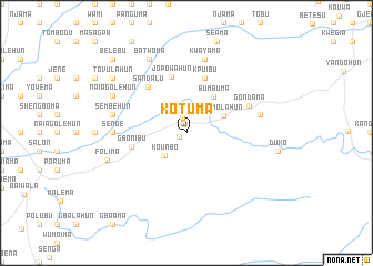
Kotuma (Lofa, Liberia)Kotuma is a town in the Lofa region of Liberia. An overview map of the region around Kotuma is displayed below.
regional and 3d topo map of Kotuma, Liberia ::
Kotuma airports ::
The nearest airport is MLW - Monrovia Spriggs Payne, located 196.8 km south of Kotuma.
Other airports nearby include ROB - Monrovia Roberts Intl (201.4 km south), FAA - Faranah (221.6 km north), Nearby towns ::
Bunabo (0.9km south west) //
Vahun (1.6km north) //
Kounbo (3.1km south west) //
Mimolahun (4.1km north east) //
Bumbuma (4.5km north east) //
Gbonibu (5.6km west) //
Jopowahun (5.8km north) //
Kpuibu (5.9km north) //
Sandalu (6.0km north west) //
Gondama (6.8km north east) //
Senge (7.3km west) //
Kwayama (7.6km north) //
Yumbo (7.6km east) //
Sembehun (7.6km west) //
Kangama (7.6km west) //
Batwoma (8.3km north west) //
Naiagolehun (8.2km north west) //
Folima (8.3km west) //
Tovulahun (9.2km north west) //
Belebu (10.4km north west) //
[all distances 'as the bird flies' and approximate] 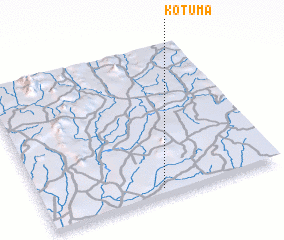 Places with similar names to Kotuma, Liberia ::
Disclaimer :: Information on this page comes without warranty of any kind |
||
|
Where is Kotuma? Elevation and coordinates ::
Latitude (lat): 8°3'0"N Longitude (lon): 10°30'0"W
Elevation (approx.): 256m (map arrows pan, magnifying glasses zoom) |
||
|
Visiting Kotuma? Hotel/Accommodation ::
Book a hotel in Kotuma Travel Guide ::
Buy a travel guide for Liberia rental cars ::
car rental offers GPS waypoint ::
download a GPX waypoint (PoI) of Kotuma for your GPS receiver
|
||