|
search place name
|
||
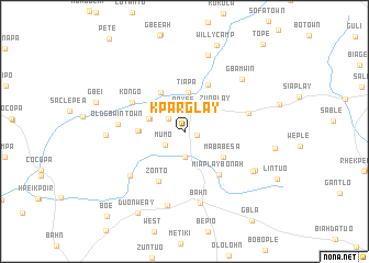
Kparglay (Nimba, Liberia)Kparglay is a town in the Nimba region of Liberia. An overview map of the region around Kparglay is displayed below.
regional and 3d topo map of Kparglay, Liberia ::
Kparglay airports ::
The nearest airport is MJC - Man, located 128.4 km east of Kparglay.
Other airports nearby include ROB - Monrovia Roberts Intl (203.3 km south west), Nearby towns ::
Bagle (1.3km east) //
Nipa (2.0km north west) //
Payee (2.2km north) //
Mumo (2.4km south west) //
Zayglay (2.6km south) //
Diopa (3.7km west) //
Korsein (3.8km west) //
Zuoplay (3.9km north east) //
Tiapa (4.0km north) //
Gbingie (4.6km north west) //
Nyeinplay (4.6km west) //
Pakle (4.7km west) //
Mababesa (4.7km south east) //
Mawe (5.3km north east) //
Miaplay-Bonah (5.6km south east) //
Zonto (5.7km south west) //
Kongo (6.0km north west) //
Old Gbain Town (6.7km west) //
Sankarplay (6.8km east) //
Zolopa (7.1km south west) //
Bahn (7.4km south) //
Dowin (7.8km south) //
Gbamwin (7.8km north east) //
Goye Town (8.0km west) //
Kpei (8.1km north) //
Gwehlay (8.1km south east) //
Bango (8.1km south east) //
Willy Camp (9.4km north) //
Duonweay (9.6km south west) //
[all distances 'as the bird flies' and approximate] 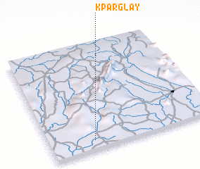 Places with similar names to Kparglay, Liberia ::
Disclaimer :: Information on this page comes without warranty of any kind |
||
|
Where is Kparglay? Elevation and coordinates ::
Latitude (lat): 7°5'26"N Longitude (lon): 8°44'9"W
Elevation (approx.): 266m (map arrows pan, magnifying glasses zoom) |
||
|
Visiting Kparglay? Hotel/Accommodation ::
Book a hotel in Kparglay Travel Guide ::
Buy a travel guide for Liberia rental cars ::
car rental offers GPS waypoint ::
download a GPX waypoint (PoI) of Kparglay for your GPS receiver
|
||