|
search place name
|
||
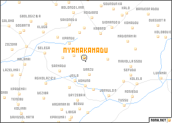
Nyamakamadu (Lofa, Liberia)Nyamakamadu is a town in the Lofa region of Liberia. An overview map of the region around Nyamakamadu is displayed below.
regional and 3d topo map of Nyamakamadu, Liberia ::
Nyamakamadu airports ::
The nearest airport is FAA - Faranah, located 220.2 km north west of Nyamakamadu.
Nearby towns ::
Diataoulédou (1.5km north west) //
Komono (2.9km north west) //
Daazu (3.0km south) //
Mawukondu (4.7km east) //
Jeila (4.8km south west) //
Nasadu (5.1km west) //
Womuna (5.3km south) //
Kpandu (5.4km north west) //
Sarmadu (6.1km west) //
Gabuzu (6.3km south) //
Kuekledu (6.5km north) //
Kpokumai (6.6km south west) //
Kabaro (6.8km north east) //
Koaton (7.3km north) //
Marvie Kounehb (8.1km north west) //
Dayzebah (8.6km south) //
Sakonedu (8.7km north west) //
Jarmulor (9.0km south east) //
Kanela (9.2km south east) //
Diomandou (9.3km north east) //
Agikolazizu (9.9km south west) //
Dazaraguézia (12.0km north west) //
[all distances 'as the bird flies' and approximate] 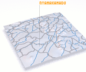 Places with similar names to Nyamakamadu, Liberia :: Disclaimer :: Information on this page comes without warranty of any kind |
||
|
Where is Nyamakamadu? Elevation and coordinates ::
Latitude (lat): 8°23'34"N Longitude (lon): 9°38'16"W
Elevation (approx.): 548m (map arrows pan, magnifying glasses zoom) |
||
|
Visiting Nyamakamadu? Hotel/Accommodation ::
Book a hotel in Nyamakamadu Travel Guide ::
Buy a travel guide for Liberia rental cars ::
car rental offers GPS waypoint ::
download a GPX waypoint (PoI) of Nyamakamadu for your GPS receiver
|
||