|
search place name
|
||
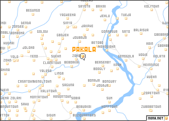
Pakala (Liberia)Pakala is a town in Liberia. An overview map of the region around Pakala is displayed below.
regional and 3d topo map of Pakala, Liberia ::
Pakala airports ::
The nearest airport is MLW - Monrovia Spriggs Payne, located 38.2 km south of Pakala.
Other airports nearby include ROB - Monrovia Roberts Intl (53.0 km south east), Nearby towns ::
Zomo (1.8km west) //
Be Boakai (3.1km south west) //
Be Tobo (4.2km north east) //
Beasemby (4.3km east) //
Joubaja (4.3km north) //
Boogly (4.3km south east) //
Be Boakai (4.8km north west) //
Hamasiahn (5.4km north east) //
Yalaba Town (5.6km south) //
Weedurow (5.6km north) //
Bonaja (5.7km south) //
Be Suawo (5.8km west) //
Senodi (5.9km north) //
Gbogli Town (6.1km south west) //
Suehn (6.3km west) //
Jodi (6.4km east) //
Cooper (6.7km north west) //
Linga (6.7km south west) //
Gbojeh (6.7km north west) //
Jakpwe (6.8km north) //
Clark Town (7.2km west) //
Saguna (7.3km south west) //
Vanjapolu (7.4km west) //
Aljennah (7.4km north east) //
Jodaja (7.5km south east) //
Gbao Number One (7.6km north) //
Liuecar (7.6km west) //
Kram (7.6km east) //
Gbao Number Two (7.7km north) //
[all distances 'as the bird flies' and approximate] 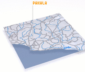 Places with similar names to Pakala, Liberia ::
Disclaimer :: Information on this page comes without warranty of any kind |
||
|
Where is Pakala? Elevation and coordinates ::
Latitude (lat): 6°37'0"N Longitude (lon): 10°39'0"W
Elevation (approx.): 67m (map arrows pan, magnifying glasses zoom) |
||
|
Visiting Pakala? Hotel/Accommodation ::
Book a hotel in Pakala Travel Guide ::
Buy a travel guide for Liberia rental cars ::
car rental offers GPS waypoint ::
download a GPX waypoint (PoI) of Pakala for your GPS receiver
|
||